Flood Documents
Flood Response Guide
DownloadImproving Flood Forecasting and Early Warning in Somalia
DownloadHydraulic Behaviour of the Juba and Shabelle Rivers
DownloadAnalysis of General Climatic Conditions in Somalia in Support of Drought Monitoring
DownloadHumanitarian Reference Grid maps Middle Juba
DownloadHumanitarian Reference Grid maps Lower Juba
DownloadHumanitarian Reference Grid maps Middle Shabelle
DownloadHumanitarian Reference Grid maps Lower Shabelle
DownloadHumanitarian Reference Grid maps Gedo
DownloadHumanitarian Reference Grid maps Hiraan
DownloadFlood information reporting format - English
DownloadFlood information reporting format - Somali
DownloadMaps
Status of River Juba Breakages - Feb 2022.
This map shows the location of the Open and Potential breakages along the Juba River as of February 2022. 35 open points were identified along the Juba River, the assessment also identified over 100 potential breakage points. Open or Potential breakages might have been omitted in some cases where updated satellite images were not very clear due to cloud cover or were not available at all.Status of River Shabelle Breakages Feb 2022.
This map shows the location of the Open and Potential breakages along the Shabelle River as of February 2022. A total of 101 open points were identified along the Shabelle River. However, Open or Potential breakages might have been omitted in some cases where updated satellite images were not very clear due to cloud cover or were not available at all.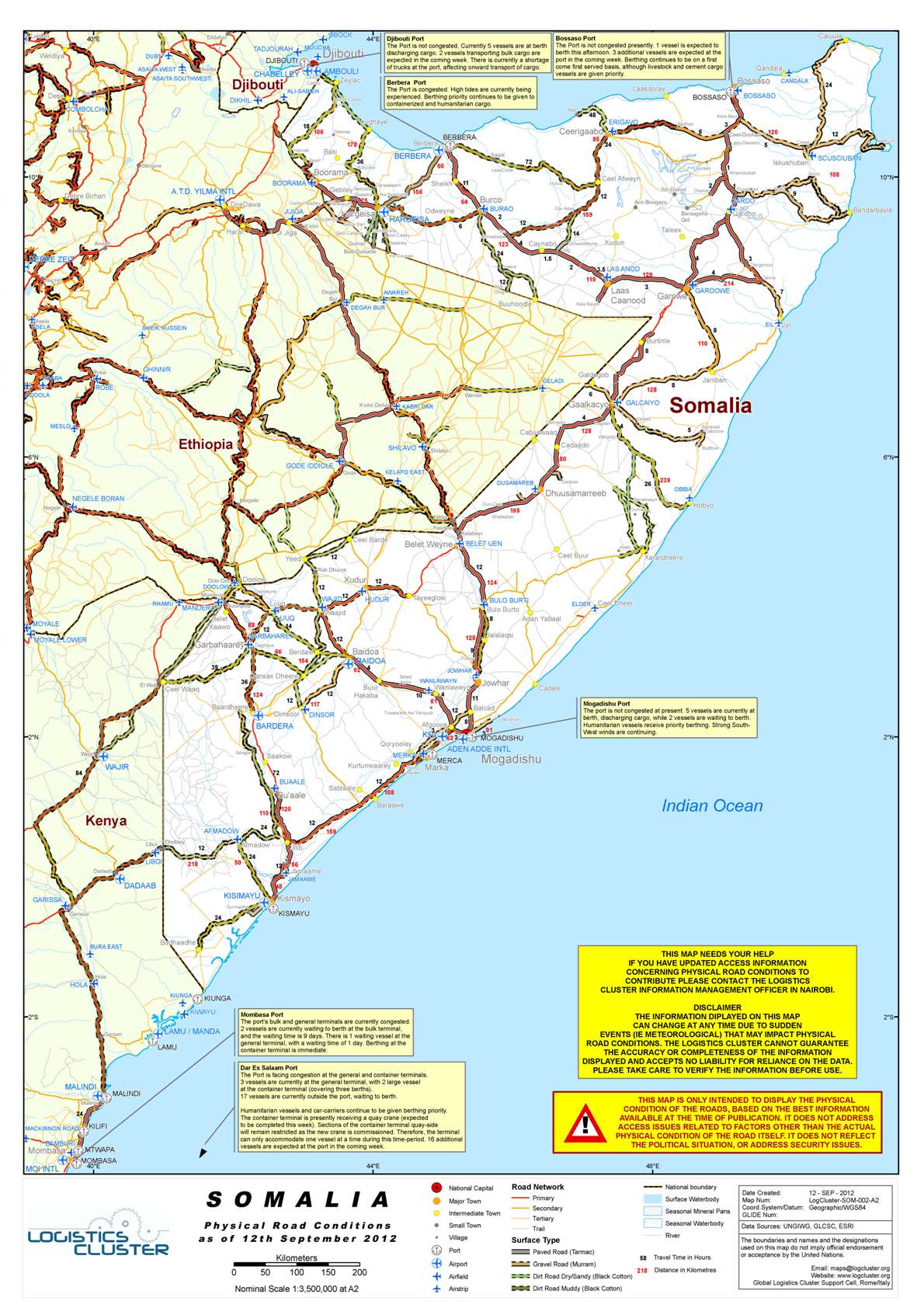
Road Conditions
View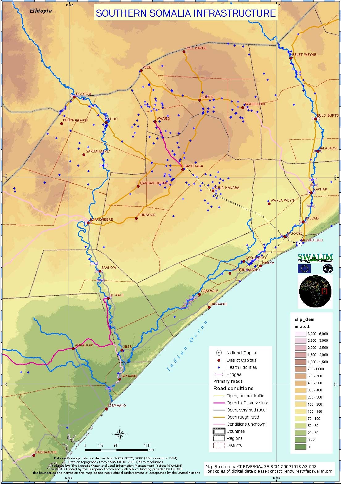
Infrastructure
View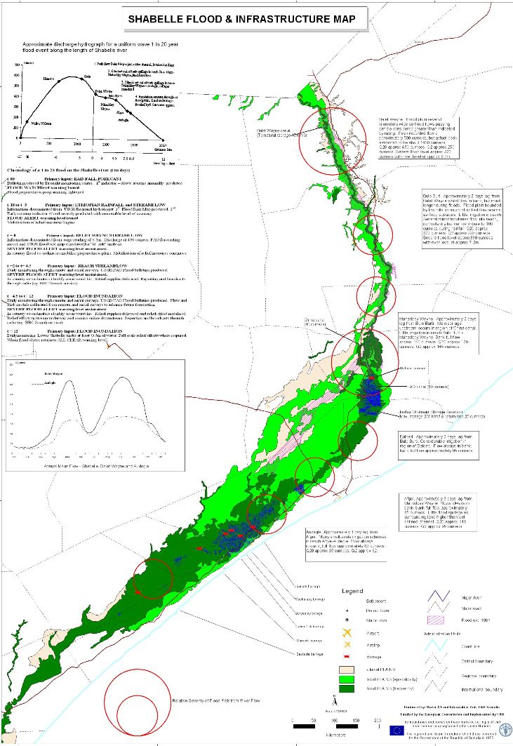
Flood Control Structures
View